Property Record
16 Vail Pkwy Nw, Rome, GA 30165
NEARBY LISTINGS FOR SALE OR LEASE
-
-
View all Rome listings for sale on LoopNet.com
Property Detail
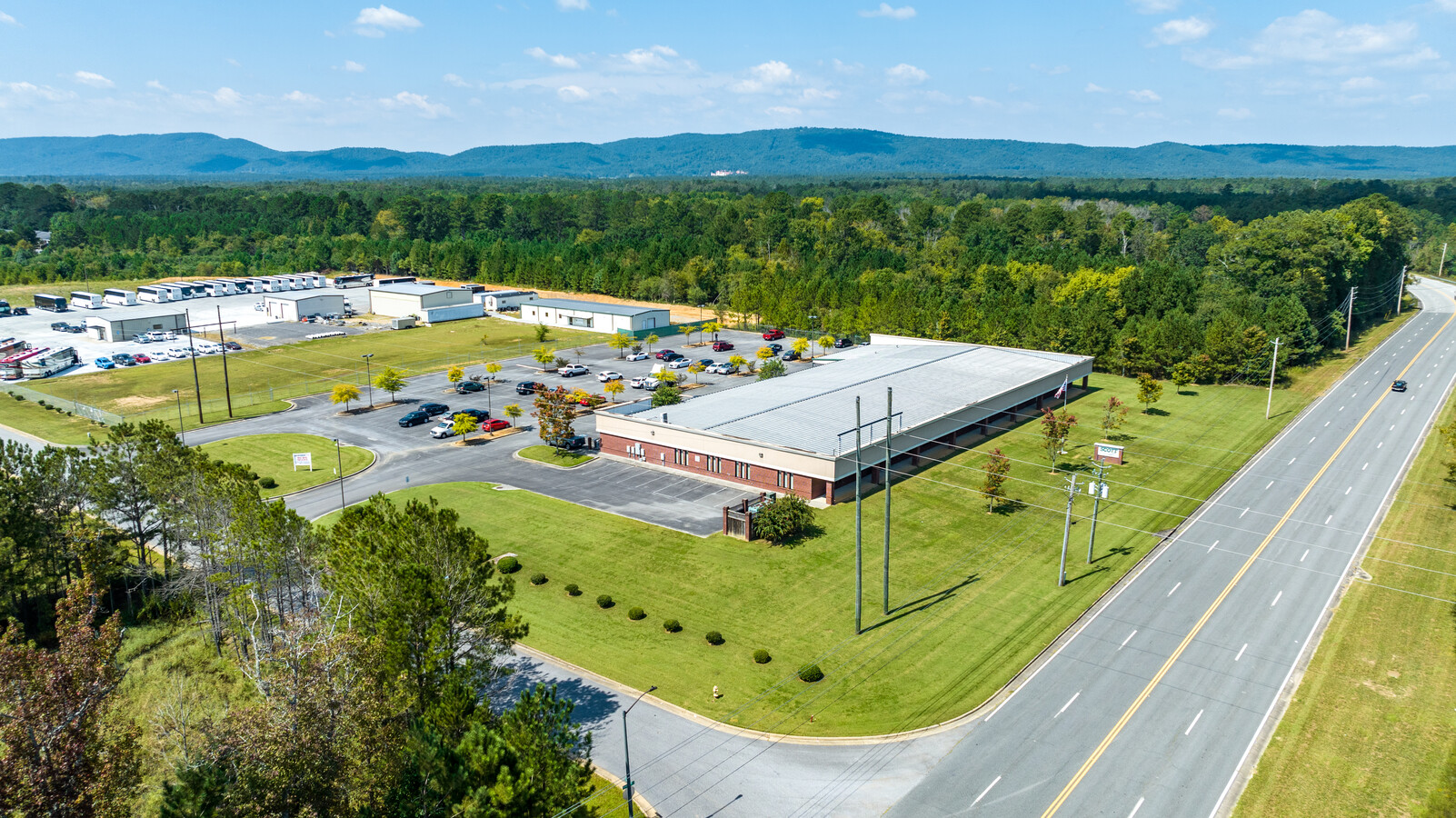
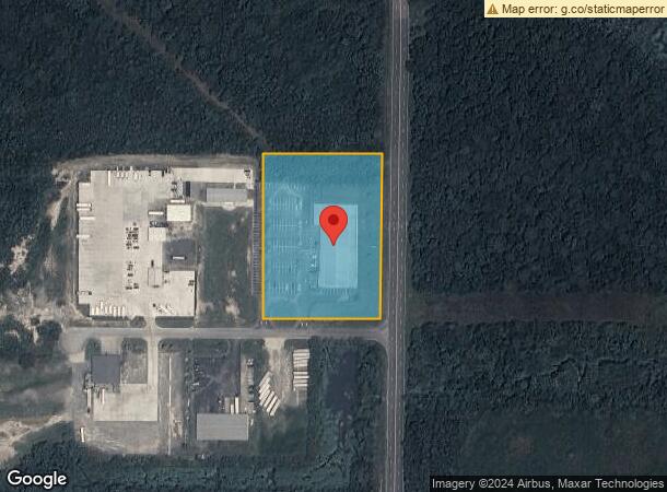
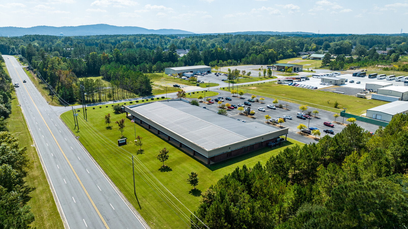
16 Vail Pkwy Nw
Rome, GA
Vail Indus Park Ph 01
I12-071
LT10 VAIL INDUSTRIAL PK PB28-168 LANDLOT: 89 LANDDIST: 4/4
Officebuilding
Floyd
X
Georgia
13115C0187E
10
2024
3.92 AC
2024
Georgia Northwest
000401
Other Market Areas
23,940 SF
DEMOGRAPHICS near 16 Vail Pkwy Nw
1 Mile
3 Mile
5 Mile
2024 Total Population
2,578
27,945
52,174
2029 Population
2,625
28,491
53,446
Pop Growth 2024-2029
+ 1.82%
+ 1.95%
+ 2.44%
Average Age
33
35
37
2024 Total Households
868
9,562
19,133
HH Growth 2024-2029
+ 1.61%
+ 2.15%
+ 2.56%
Median Household Inc
$63,442
$60,687
$60,444
Avg Household Size
2.80
2.60
2.50
2024 Avg HH Vehicles
2.00
2.00
2.00
Median Home Value
$129,850
$160,558
$173,188
Median Year Built
1973
1974
1973
Nearby Places
- Restaurants
- Banks
- Shops
- Fitness
- Groceries
SALE & LEASE HISTORY
LISTING DATE
SALE/LEASE

Oct 22, 2022
For Sale
Nearby Properties
Address
Land Use
TOTAL SIZE
Lot Size
Zoning
Address
Land Use
TOTAL SIZE
Lot Size
Zoning
136,498 SF
9.23 AC
O-I
Address
Land Use
TOTAL SIZE
Lot Size
Zoning
1 SF
767.46 AC
O-I
Address
Land Use
TOTAL SIZE
Lot Size
Zoning
Address
Land Use
TOTAL SIZE
Lot Size
Zoning
4,394 SF
14.26 AC
Address
Land Use
TOTAL SIZE
Lot Size
Zoning
30,991 SF
8.94 AC
Address
Land Use
TOTAL SIZE
Lot Size
Zoning
11,712 SF
35 AC
H-I
Address
Land Use
TOTAL SIZE
Lot Size
Zoning
5,386 SF
30.65 AC
C-C
Address
Land Use
TOTAL SIZE
Lot Size
Zoning
54,817 SF
8.82 AC
C-C
Address
Land Use
TOTAL SIZE
Lot Size
Zoning
75,156 SF
7.10 AC
O-I
Address
Land Use
TOTAL SIZE
Lot Size
Zoning
52,321 SF
Address
Land Use
TOTAL SIZE
Lot Size
Zoning
45,492 SF
7.76 AC
C-C
Address
Land Use
TOTAL SIZE
Lot Size
Zoning
47,541 SF
5.24 AC
O-I
Address
Land Use
TOTAL SIZE
Lot Size
Zoning
137,726 SF
12.51 AC
C-C
Address
Land Use
TOTAL SIZE
Lot Size
Zoning
30,267 SF
7.20 AC
C-C
Address
Land Use
TOTAL SIZE
Lot Size
Zoning
59,082 SF
8 AC
C-C
Address
Land Use
TOTAL SIZE
Lot Size
Zoning
89,250 SF
35 AC
H-I
Address
Land Use
TOTAL SIZE
Lot Size
Zoning
84,460 SF
6.83 AC
C-C
Address
Land Use
TOTAL SIZE
Lot Size
Zoning
201,166 SF
23.29 AC
C-C
Address
Land Use
TOTAL SIZE
Lot Size
Zoning
313,467 SF
0.13 AC
H-I
Address
Land Use
TOTAL SIZE
Lot Size
Zoning
9,000 SF
7.90 AC
M-R
Address
Land Use
TOTAL SIZE
Lot Size
Zoning
36,301 SF
11.57 AC
O-I
Address
Land Use
TOTAL SIZE
Lot Size
Zoning
78,937 SF
18.61 AC
O-I
Address
Land Use
TOTAL SIZE
Lot Size
Zoning
18.68 AC
C-C
Address
Land Use
TOTAL SIZE
Lot Size
Zoning
4.51 AC
M-R
Address
Land Use
TOTAL SIZE
Lot Size
Zoning
137,373 SF
17.25 AC
Address
Land Use
TOTAL SIZE
Lot Size
Zoning
34,900 SF
H-I
Address
Land Use
TOTAL SIZE
Lot Size
Zoning
32,572 SF
2.84 AC
C-C
Address
Land Use
TOTAL SIZE
Lot Size
Zoning
1,343.70 AC
A-R
Address
Land Use
TOTAL SIZE
Lot Size
Zoning
109,844 SF
11.86 AC
C-C
Address
Land Use
TOTAL SIZE
Lot Size
Zoning
96,887 SF
6.70 AC
C-C
The World's #1 Commercial Real Estate Marketplace
Connect with us
© 2025 CoStar Group
The information above has been obtained from sources believed reliable. While we do not doubt its accuracy we have not verified it and make no guarantee, warranty or representation about it. It is your responsibility to independently confirm its accuracy and completeness. Any projections, opinions, assumptions, or estimates used are for example only and do not represent the current or future performance of the property. The value of this transaction to you depends on tax and other factors which should be evaluated by your tax, financial, and legal advisors. You and your advisors should conduct a careful, independent investigation of the property to determine to your satisfaction the suitability of the property for your needs.